Geographic Information Systems
-
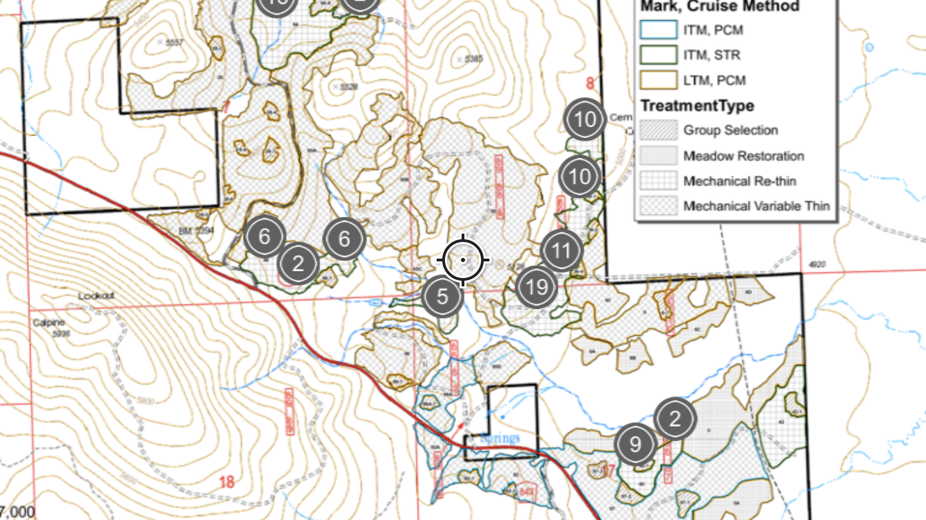
Mapping
Maps are a requirement for most permitted forestry projects that occur in the jurisdiction of a state agency and are an essential navigational tool for our foresters and biologists. We can also produce maps for clients seeking reconnaissance information on their property. We strive for visual clarity and attention to detail.
Document Disposal Policy
Your privacy matters to us. As with all forms of sensitive client information, excess, physical iterations of maps with confidential information are promptly destroyed. -

GPS Data
Our foresters and technicians use high-precision GPS hardware to collect project data, which is then differentially corrected using carrier and code correction software. This service is standard for most timber harvest needs.
-
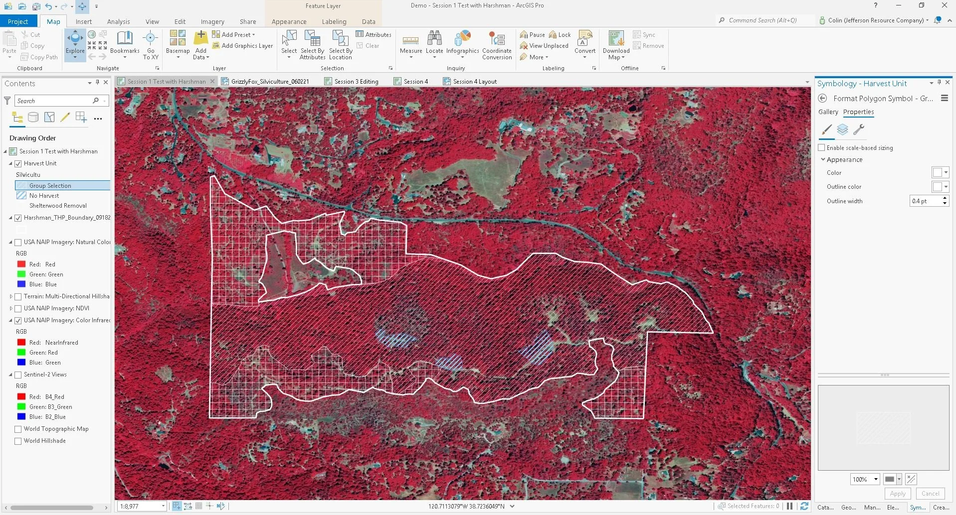
Geospatial Analysis
Our GIS department utilizes a large library of in-house data and a vast array of publicly available data sources to inform management decisions for our clients’ projects. We can generate client data using both ArcMap and ArcGIS Pro software and provide clients with access to their project-specific data in geodatabase and shapefile/folder packages upon request. Our GIS department specializes in efficient workflow to produce products that meet strict state-agency review standards.